Unwind the clock of modern life. Unlock the door to a wonder of the world.
Sarajevo compresses architecture, terrain, and history into short, high-density segments. The old bazaar quarter carries the Ottoman imprint: stone alleys, courtyards, and metalwork stalls operating on the same parcels that defined the pre-industrial city. A few blocks west, the fabric flips into Austro-Hungarian order—straight tram corridors, decorated façades, and civic institutions set on wide boulevards. The river walk links both systems, marked by stone bridges and the site that triggered the First World War. Hill viewpoints sit close above the center; their geometry explains how the basin was watched and defended. Museum work covers the modern period, from daily life in the siege to the deeper national archive. Elevated ground at Trebević opens the full valley, while the Ilidža spring shifts the focus to water, trees, and slow approach paths. The city reads cleanly when taken as alternating clusters of craft alleys, imperial blocks, linear riverfront, and steep ridgelines.
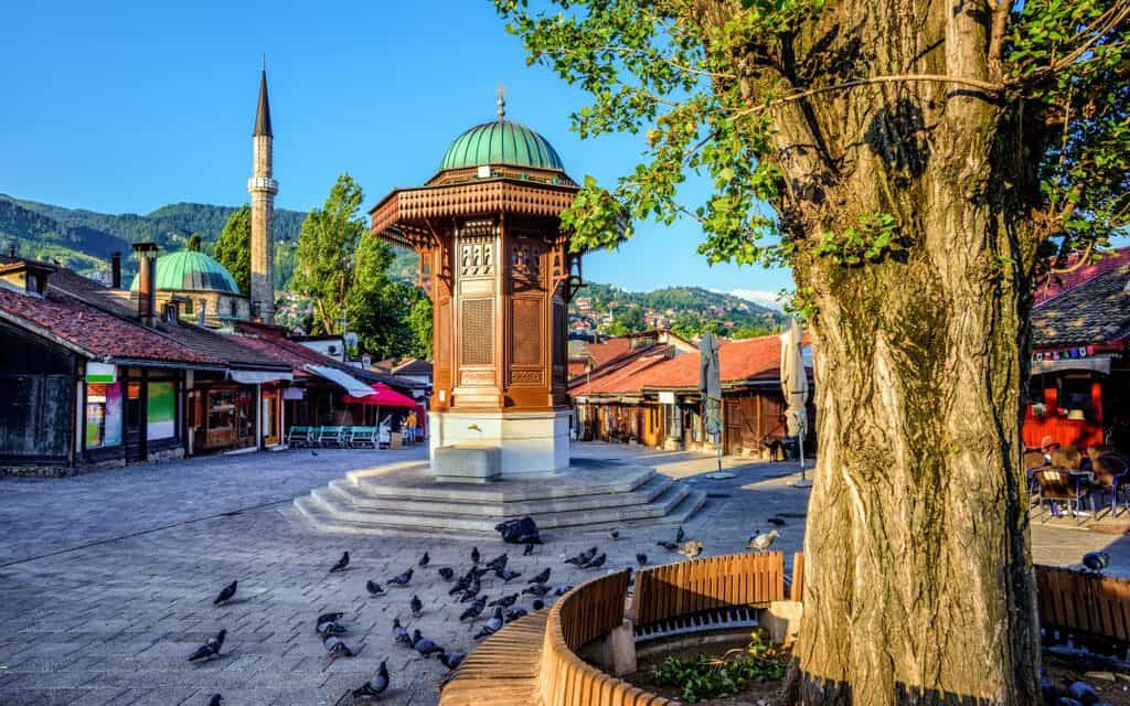
Sebilj, Baščaršija
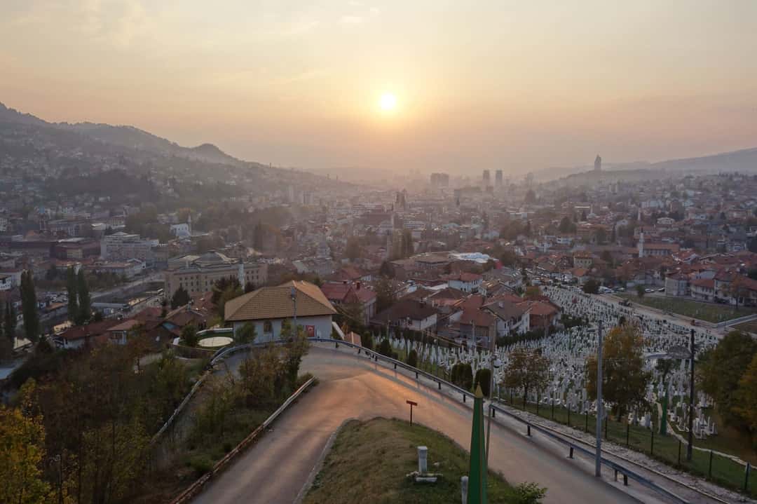
City skyline from Žuta Tabija
Žuta Tabija is one of Sarajevo’s surviving hillside fortifications, built in the early Ottoman period as part of the city’s defensive ring. Its position above the old town gives a clear view over the Miljacka valley and the entire historic core. The structure itself is a compact stone bastion with restored walls and an open upper platform. It’s used as a viewpoint rather than an enclosed monument. Sunset visibility is the defining feature: the full city grid, the minarets, the Austro-Hungarian districts, and the ridge lines sit in a single frame. Access is by a short, steep approach from Vratnik. The site carries military architecture, the topography of Sarajevo’s expansion, and its later role as an observation point during the siege.